Flood management master plan template for Malaysia
Dr Rais Hussin and Ameen Kamal04 Jan 2022 12:46pm

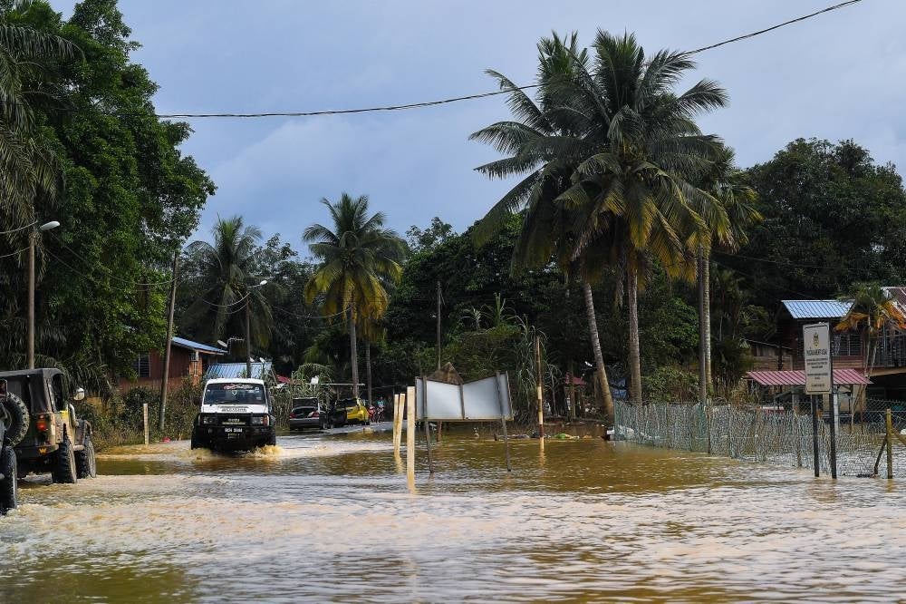
A four-wheel drive gushing through flooded road at Kampung Paya Panjang, Bera in Pahang on Monday. Overflowed river water from Triang River and Pahang River inundated the village following continuous over the weekend. (Source: Bernama)
Non-structural solutions
Flood experts and hydrologists generally agree that an ideal framework for flood management must have a balanced combination of structural and non-structural solutions.
Non-structural solutions include early warning systems (forecasting and detections), readiness in disaster relief and emergency response, legislations, and policies. Structural solutions include engineering and design solutions that can be applied to existing and new buildings, urban development, and physical structures to increase resilience to disaster events.
In the immediate term, the most important thing is to ensure readiness in emergency operations and the provision of aid. Frequent rains are expected in the coming weeks and months, and disaster relief assets must already be mobilised and on high-alert mode. Armed forces should be on standby to provide assistance.
There must be a restructuring and legislative enforcement to clarify the role of The National Disaster Management Agency within the frameworks under the National Security Council, and coordination issues between the district, State, and Federal authorities must be ironed out through frequent drills.
In the short term, flood forecasting and warning systems need to be improved via expansion of monitoring areas, sensors and use 4IR technologies to crunch big data from multiple sources and use artificial intelligence for improved predictions.
For example, as published in Nature September this year, artificial intelligence (AI) company DeepMind demonstrated accurate short-term rain forecasts through “deep generative models” of meteorological data. Bigger data sources through data sharing across national boundaries may provide even better forecasts.
Advanced warning, even as short as a few hours earlier can make a difference in mobilising emergency responses, and allowing people lead time to evacuate and avoid flood-prone areas, saving lives and potentially reducing related damages. Thus, communication to the public should be improved by merging MyCuaca app functionality with the widely used MySejahtera app.
What is also needed immediately is the identification of flood-prone areas, water flood plains, and drainage corridors for gazetting, to be protected and perhaps even artificially expanded under National Security provisions.
Flood maps by various researchers are available but must be updated continuously given changes in topography via natural and man-made reasons such as developments, weather fluctuations, and climate change.
As mentioned in a Irrigation and Drainage Department document, mechanisms to deal with areas identified in flood maps include development restrictions, zoning for land use, and population resettlement.
Although these examples of non-structural solutions are relatively easier to implement compared to structural solutions, they must be complemented with structural approaches that are also needed in the immediate term.
Structural Solutions
There is an urgency to apply engineering solutions for flood-proofing and disaster-resistant designs or upgrades to essential structures related to national security - electrical power stations, the armed forces, healthcare facilities, water and food supplies networks, oil and fuel systems and reserves, disaster relief, and rescue organisation assets - particularly in known flood-risk areas, flood plains, and drainage corridors.
In the medium term, there is a need for new standards in infrastructure designs, urban development, or deforestation to qualify for stricter ecological sustainability and better environmental footprint.
New Urban Development Standards
New design standards and architectural philosophy should learn from nature: how trees, vegetations, soil composition, etc. slow down rainwater, which then flows into the fast-flowing river to carry it downstream, preventing flooding in rainforests.
This is why conservationists call for a stop to deforestation, and the protection of natural flood plains as part of the strategy to mitigate flood.
However, for a growing country like Malaysia, this may not be so straightforward, and a balance must be achieved. For example, expansion of flood plains in Kelantan might entail sacrificing paddy fields which impacts another area of concern for Malaysia (food security) and involve resettlements of rural folks that rely on this as their home and livelihood.
That said, illegal and unsustainable logging practices must be curbed through tighter regulations, monitoring, and enforcement. Virgin forests help prevent water runoff, landslides, and many other benefits. Therefore, it is unsurprising that places with heavy deforestation such as Pahang experienced extreme flooding. It’s time to stop blaming Mother Nature and realise that these disasters are man-induced.
At minimum, infrastructure design and development must measure how much water catchment and rate of water runoff prevention a particular virgin land provides.
Any development on new lands must be built in such a way that the original water catchment and reduction in runoff water is replaced. Individual structures should be designed to slow down water movement so as to not overburden the drainage systems with run-off water, while drainage systems should be flowing as rapidly as possible to prevent flooding.
Thus, anything that slows down the flow, such as rubbish build-up must be removed. Frequent monitoring and servicing of drainage systems in these areas are also crucial. Consequently, new protocols to clean and flush critical drainage routes must be tied to early warning systems.
Note that this does not replace the biodiversity and natural ecology, whereby its loss would have a far-reaching impact, beyond flood mitigation.
New building designs should incorporate nature harmoniously, such as trees, etc. instead of sterile concrete-metal architectures that increase water runoff.
Examples of the use of traditional physical barriers such as levees and embankments, and innovative use of tunnels and tanks to capture floodwater underground, and other examples can be referred to in EMIR Research article “Flood management – please come up with a masterplan” by Dr Rais Hussin and Jason Loh.
Prevention Mentality and Respond Mentality
The Netherlands is a global leader in dealing with floods and should be an example for Malaysia. Reportedly over two-thirds of their population is below sea level and faces frequent storms. They experience a massive flood in 1953 which killed nearly 2000 people, but due to advanced and massive structural changes, The Netherlands has reportedly not faced any flood-related deaths ever since.
What did the Dutch do right? They went all-out in landscaping and urban development principles adopting the “prevention mentality” instead of relying solely on the “respond mentality”.
The Dutch built dikes and damns, reportedly strong enough to withstand extreme weather for thousands of years, based on computer simulations and projections. They built the Maeslantkering, which are basically giant gates the size of two Eiffel towers, acting like damns protecting it against surges from the sea during storms.
The show 60 Minutes documented very well how Rotterdam is a world-class example of preventive/defensive urban designs. It reported basketball courts that can hold 450,000 gallons of storm runoff water, sloping parks on top of shopping centres that act as a storm surge barrier, water recreation facilities acting as a flood reservoir, man-made dunes along the North Sea that protect towns from sea surge and storms, parking garages built under these dunes to raise the heights of the dune plains’ height 25 feet above sea level, and many more.
Even simpler things such as constructing sidewalks, pavements, and roads with blocks and rooftops with vegetation (“Sponge City” approach) that provides a combination of additional water holding volume and slowing down water runoff can collectively make a difference in the larger scale of things.
Likewise, Malaysia should adopt similar design principles which require new standards to blend urban development designs and architecture with disaster prevention form and function.
For older cities, innovative drainage systems that swiftly redirect increased water runoff at the community level will be needed. As reported, Malaysia’s Smart Tunnel successfully diverted five million cubic metres of excess water, which prevented flooding at the Kuala Lumpur city centre.
Existing underutilised sites should be used for more deployment of hybrid solutions, such as The Hybrid Off River Augmentation System (Horas) project which utilises depleted mining land for storing stormwater runoff and underground water.
Malaysia has had decades of experience with major flooding events and has the highest percentage (67%) of the population exposed to floods among ASEAN Member States. Just like The Netherlands, Malaysia has all the reasons to pursue drastic, long-term flood management strategies nationwide.
Malaysia has an existing guideline for disaster resilient urban planning, which must be updated with the latest urban development designs and standards as part of the national flood management strategy.
These solutions can be applied in varying intensities and along with different timelines, according to their priority levels. In the following table, we demonstrate an example action plan taking into account solutions mentioned above into priority levels and focus areas, for both new and existing developments.
These are non-exhaustive and specific engineering solutions that have already been researched and developed by experts should be referred to for more details.
An important lesson from the Dutch experience is noted in a research article by Alcoforado FAG, whereby large public investments in flood control infrastructure are not only effective but can be more economical than responding after a disaster.
For example, catastrophes caused by hurricane Katrina in New Orleans (which does not have the Dutch solutions at that time) reportedly resulted in US$ 150 billion worth of losses and many lives lost. Hurricane Sandy reportedly caused US$ 70 billion in damages and killed hundreds of people.
The Dutch government avoided these costs by “investing” more than US$ 1 billion annually on flood management measures and spent US$ 500 million over six years to build the Maeslantkering gates. This resulted in The Netherlands recording no flood-related deaths ever since its disastrous 1953 flood.
On this note, Malaysia’s government must allocate related budget using Input-Output-Outcome-Impact (IOOI) framework to implement both structural and non-structural mitigation plans, to ensure financial prudence and oversight in increased expenditure, and get expert help from agencies of nations that are used to national level disasters such as experts from Dutch authorities and The Japan International Cooperation Agency (JICA).
In the long term, and beyond flood management, widespread use of renewables (chemicals, materials, and energy) and implementation of Circular Economy principles will have to be established, as part of Malaysia’s contribution to global climate change efforts, and local environmental and natural resource protection.
Dr Rais Hussin and Ameen Kamal are part of the research team of EMIR Research, an independent think tank focused on strategic policy recommendations based on rigorous research.
Download Sinar Daily application.Click Here!