14 areas in Langkawi hit by flood


ALOR SETAR - Floods have hit 14 areas in four sub-districts (mukim) in the Langkawi Island due to heavy rains and strong winds since 6pm on Sunday.
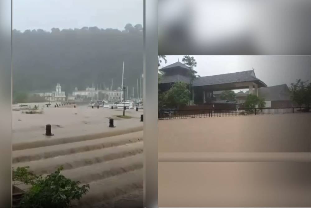
Langkawi district Malaysian Civil Defence Force (APM) officer Captain (PA) Ahmad Shahfikri Darus said as of 4pm, among the areas affected by floods in mukim Kuah were Kampung Belanga Pecah and Jalan Penarak.
Ahmad Shahfikri who is also the District Disaster Management Committees (JPBD) secretariat said five areas including Telaga Habour Pantai Kok, Kampung Atas, Kampung Sungai Melaka, Fresh Mart Padang Putih and Market Padang Padang Matsirat in mukim Padang Matsirat were also flooded.
"For mukim Ayer Hangat, the affected areas include Kampung Kilim, Teluk Yu, Jalan Kelubi and Bukit Tampoi, while in mukim Ulu Melaka, the Padang Gaong Dam, Padang Saga Dam and a restaurant were affected.
“Besides the floods, there were also landslides in mukim Ulu Melaka and Jalan Gunung Raya," he said in a statement on Sunday.
Ahmad Shahfikri said he also identified incidents of fallen trees in several areas such as Jalan Perana mukim Ulu Melaka and Kampung Padang Ranggut as well as in front of Sekolah Menengah Kebangsaan (SMK) Ayer Hangat in mukim Ayer Hangat.
"There were also fallen trees in Kampung Belanga Pecah and Kampung Keda Tok Wang Rendong in mukim Kuah as well as Kampung Lubuk Semilang and Kampung Yooi in mukim Bohor," he said.
However, he said no temporary evacuation centres (PPS) were opened as of 4pm on Sunday.
“It is still raining heavily in Langkawi and also strong winds. We are still monitoring the flood-prone areas," he said.
Meanwhile in Perlis, several residential areas and villages in Kangar have been hit by floods due to persistent rainfall since Saturday.
Perlis APM director Lieutenant Colonel (PA) Mohd Izaimi Md Daud said among the affected areas were Kampung Sentua, Kampung Seriab and Kampung Bakau.
“Perlis APM is also monitoring flood hotspot areas as well as rivers that are at yellow levels around Perlis," he said.
He said observation and assistance have been deployed in Taman Kuala Perlis and Kampung Sentua.
"However, until now no temporary evacuation centres (PPS) are opened as APM is actively assisting residents to move items in the affected areas," he said.
In the same development, the Padang Besar Operations Control Centre was actively conducting river level surveys at Sungai Panggas, Sungai Buluh Batu Bertangkup, Sungai Kubang Tiga and Bukit Ayer.
APM Perlis said the river was at the yellow level and there were torrential currents.
Download Sinar Daily application.Click Here!


