Interaction of three tectonic plates caused strong quake in Sabah - Expert
Deep earthquakes often relax faster compared with those that rupture close to the surface.

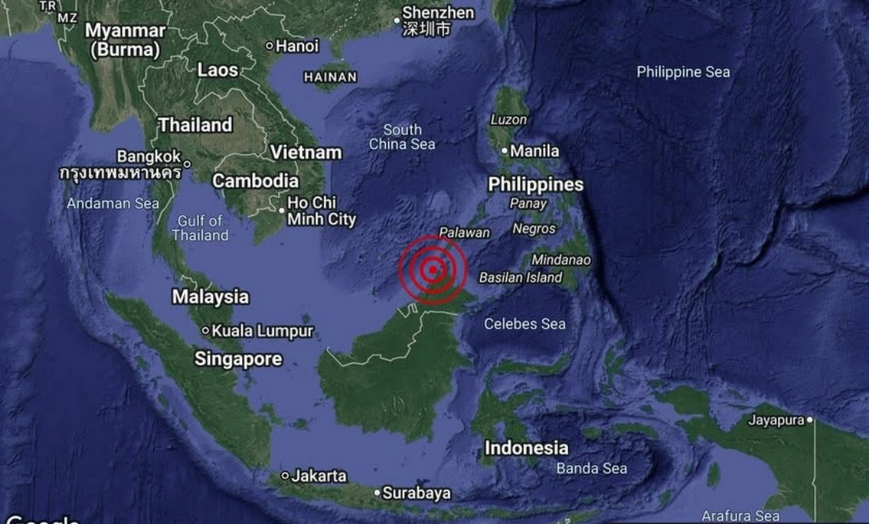
KUALA LUMPUR - Movements and pressure occurring between three major tectonic plates in the subduction zone near Sabah have been identified as the main factors likely triggering the strong 6.8-magnitude earthquake in the state’s waters shortly after midnight.
Senior Lecturer of the Marine Geoscience Programme at Universiti Malaysia Terengganu (UMT), PGeol Dr Muhd Nur Ismail Abdul Rahman explained that the collision and dynamic interaction between the Indo-Australian, Eurasian and Philippine plates caused a significant build-up of energy within the earth’s crust.
According to him, when the pressure exceeded the rock strength threshold, the stored energy was released abruptly, resulting in a strong tremor measuring 6.8 on the Richter scale.
He noted that although the earthquake registered a large magnitude, its depth of 678 kilometres (km) meant the risk of major damage was low.
"Very deep earthquakes can be felt over a wide area, but their intensity at the surface is usually weaker. For quakes at such depths, aftershocks are typically smaller and less frequent compared with shallow earthquakes,” he told Bernama today.
Muhd Nur Ismail said Sabah remains the most vulnerable area in Malaysia due to its proximity to the subduction zone compared with other regions.
Meanwhile, Southeast Asia Disaster Prevention Research Initiative (SEADPRI-UKM) Research Assistant B. Navakanesh described the phenomenon as Deep Slab Deformation.
"This means the earthquake occurred on a subducted slab rather than along a fault system as seen in previous earthquakes. Under high pressure at such depth, the slab can accumulate stress and eventual failure may release massive energy.
"Since it occurred at such depth, most of its energy was absorbed by the mantle and crust. The waves that reached the surface were mainly low-frequency waves which caused less harm. There should be no risk,” he said.
Commenting on the likelihood of aftershocks, Navakanesh explained that deep earthquakes often relax faster compared with those that rupture close to the surface.
"Despite our locations appearing close, in reality we are not directly linked. Most of what we experience are intraplate earthquakes which may be reactivated for various reasons. However, the present-day boundary still poses certain threats, where stress could migrate to local fault systems,” he added.
Professor Gs Dr Rosmadi Fauzi from the Department of Geography, Universiti Malaya (UM), said the incident was a clear signal that Malaysia is no longer immune to tectonic risks.
The Geographic Information System (GIS) mapping expert said the country’s focus must now shift towards identifying potential hazards through mapping technology to support more effective preparedness.
"Disasters do not begin with events, but with space. It is time to strengthen geography education in schools to build a society that is more aware of disaster risks and spatial safety,” he said.
Earlier, Director-General of the Malaysian Meteorological Department (MetMalaysia) Dr Mohd Hisham Mohd Anip said the earthquake, centred 49 km west of Kudat, posed no tsunami threat but was the strongest to hit the country in the past 11 years. - BERNAMA
Download Sinar Daily application.Click Here!


