Gulf of despair: How Kampung Pantai Sabak is drowning under the weight of erosion
Severe coastal erosion began after the completion of a river mouth project in Kemasin, Bachok, followed by the construction of a wave breaker.


KOTA BHARU - What was once a vibrant seaside village in Kelantan is now a haunting memory submerged by the sea.
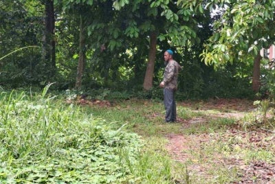
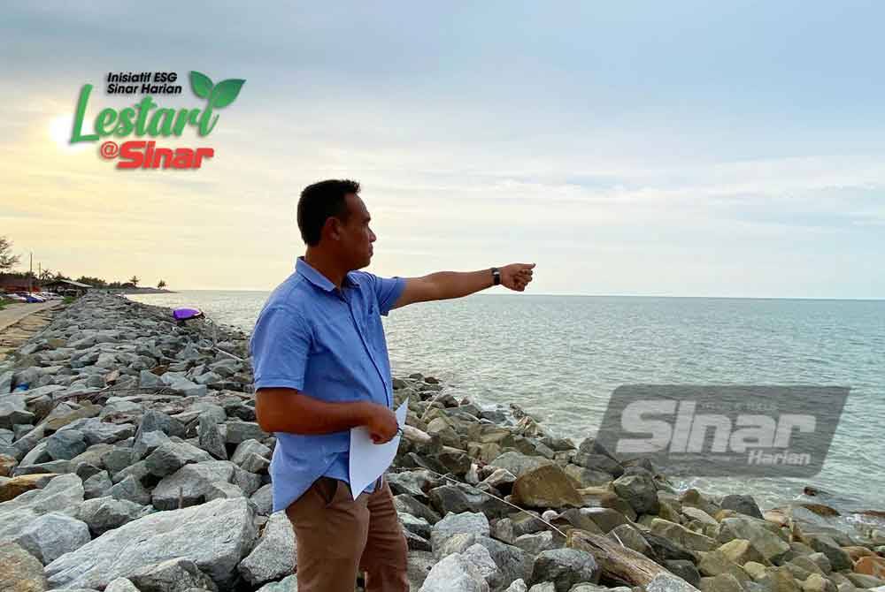
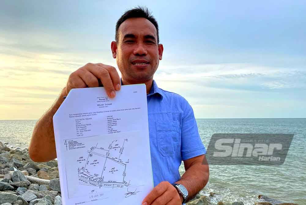
Residents of Kampung Pantai Sabak, including former village head Azammanan Ahmad, 53, have witnessed their land disappear over more than three decades of coastal erosion, leaving behind just memories and land grants to prove their ownership.
He said severe coastal erosion began after the completion of a river mouth project in Kemasin, Bachok, followed by the construction of a wave breaker.
As a result, this caused stronger wave movements along the coast near Kampung Pantai Sabak, which accelerated the erosion process.
“Based on experience, erosion started in the 1980s, but the worst period was around 1988 when I was in Form Four. At that time, waves had begun to eat away at the coastline.
“The peak of the erosion occurred over five years starting in 1988, during which 107 homes were destroyed. To make matters worse, what used to be land has turned into sea.
“Imagine, nearly 500 metres from the current stone barrier to the sea used to be residential land, but it has all submerged,” he told Sinar.
As a teenager, he recalled that during high tides, he saw houses collapse within just 10 to 30 minutes.
He noted that every evening, villagers would prepare themselves; their belongings would be packed and stored in the homes of neighbours further inland in anticipation of the high tides.
Azammanan shared that in the early 1990s, efforts were made to reclaim land by dredging sand from the seabed and depositing it onshore over a stretch of about 12 metres, but it was swallowed by the sea within a year.
Due to the ongoing erosion, many residents of Kampung Pantai Sabak were forced to relocate, though not all were fortunate enough to receive new housing.
“Four new settlements were established, Pulau Gajah (Blocks A and B), Baruh Masin and Kampung Tok Guru. However, as of 2024, 26 families have still not received any resettlement.
“Many have had to rent or live with relatives. This village used to be full of residents, but now only around 1,000 people remain,” he said.
He added that while the state government has provided land plots for erosion victims, no cash compensation has been given.
Azammanan noted that Kampung Pantai Sabak, once known for the Japanese army landing and as a fishing hub, is now nothing but a memory.
Seven beaches in Kelantan experience up to four metres of erosion annually
The Kelantan Department of Irrigation and Drainage (DID) has revealed that seven coastal areas in the state are facing critical erosion.
DID director Dr Siti Fairus Zakaria stated affected areas include Pantai Sabak, Mek Mas, Kuala Besar, Tok Bali, Bisikan Bayu, as well as the mouths of the Kelantan and Semerak Rivers.

“Studies show erosion rates range from one to four metres per year, especially during the monsoon season. A combination of king tides and strong waves from the South China Sea contributes significantly to the problem,” she said.
Kelantan DID is currently taking the ongoing issue seriously by conducting regular monitoring and technical studies.
Cross-agency collaboration is also being carried out to ensure the long-term safety of coastal areas and the wellbeing of coastal communities.
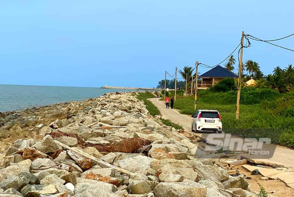
Among the mitigation measures implemented are the construction of a 3,000-metre wave breaker, the installation of rock revetments in critical zones, dredging works at the Kelantan River mouth and the construction of a training wall to regulate river flow.
Dr Fairus highlighted that one of the key benefits of these projects is the reduction of private land loss in Kampung Pantai Mek Mas and Kundor and enabling over 90 fishing boats to operate safely year-round.
“The sedimentation issue at the river mouth, which affects the marine economy, has also been addressed, and water outflow has improved, reducing upstream flood risks.
“One of the major projects with significant local impact is the Coastal Protection Project at Pantai Sabak and Pantai Mek Mas, implemented under Rolling Plans of the 11th and 12th Malaysia Plans (RMK-11 and RMK-12),” she said.
Dr Fairus added that findings from the Integrated River Basin Management Plan (ISMP) study showed only 42 per cent (19 kilometres) of the coast is stable.
According to her, 30 per cent (20.4 kilometres) is undergoing natural land reclamation, while six per cent is categorised as critically eroded.
For private landowners affected by erosion, the DID holds engagement sessions with them and relevant agencies to explore localised solutions such as boundary alignment, structure relocation, and targeted protection.
Commenting on compensation for landowners who lost their plots to erosion, she clarified that legally, compensation is not applicable as no party can be directly held accountable.
“However, DID will record erosion incidents and their effects on private land for reference by local authorities and the land office.
“Proposals for land zone relocation or restructuring will be submitted to relevant agencies including the Land and Mines Department, in line with the State Structure Plan and Local Plan,” she said.
She also mentioned that in some special cases involving public development projects that are proven to cause erosion, compensation can be considered if directly linked to licensed human activities.
Download Sinar Daily application.Click Here!